You are using an out of date browser. It may not display this or other websites correctly.
You should upgrade or use an alternative browser.
You should upgrade or use an alternative browser.
Minnesota Hunting Atlas
- Thread starter Dakotazeb
- Start date
Munster927
Well-known member
I'd be curious to know also. But my answer is not that I know of. The only maps I know of are the Walk in Area map (which is an absolute shit map IMO) and then there is the map you can buy, which is the All Outdoors Atlas. But it doesn't have WIAs or new WMAs of course. But I just draw them in each year.
Your best bet is the maps on the DNR Recreation Compass site. But it's not a hard copy of course.
Your best bet is the maps on the DNR Recreation Compass site. But it's not a hard copy of course.
Munster927
Well-known member
I agree the WIA maps do fine, but I've found some roads aren't marked, it's just a line with no road name (that are marked on my Outdoors Atlas) and some pages they print weird. The area I primarily hunt, ends up being printed on half the page because of the small area before you'd hit SD on the map. So it's even extra small. The map itself is fine, they could just make it a little more user friendly. The free maps I get for SD and Nebraska are great maps. I wish MN would do the same.
Rogue Hunter
Active member
The De Lorne Altas for Minn used to be real good for showing WMA & WPA. In the truck they last for 3-4 years. But the new atlas don't show near the detail they use too. And never did show the WIA. Using both the atlas and the DNR WIA booklet works fairly well.
jackrabbit
Active member
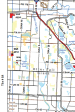
Not that I know of, but they do have books of the Walk-In Access. Which I don't completely get the point of... either list all the public land or don't waste the money on making something with a fraction of it...
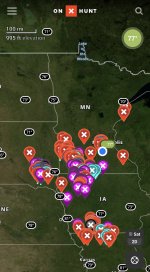
A few options... OnX. MN Recreation Compass. Or MN Recreation Compass and screenshot the areas you are targeting ahead of time, or print out the areas.
A few options... OnX. MN Recreation Compass. Or MN Recreation Compass and screenshot the areas you are targeting ahead of time, or print out the areas.
BRITTMAN
Well-known member
I will share that the DNR compass has (well at least in the past) been really, really slow in updating. It often took a year or more for new and added land to show up. I would contact the DNR and they would send me separate info.
Not sure if the new areas are marked faster now or not. I have not felt the need to branch out lately.
I have spoke to the DNR guys at Pheasant Fest and they acknowledged the issue, but did not have a great explanation.
Not sure if the new areas are marked faster now or not. I have not felt the need to branch out lately.
I have spoke to the DNR guys at Pheasant Fest and they acknowledged the issue, but did not have a great explanation.
I will share that the DNR compass has (well at least in the past) been really, really slow in updating. It often took a year or more for new and added land to show up. I would contact the DNR and they would send me separate info.
Not sure if the new areas are marked faster now or not. I have not felt the need to branch out lately.
I have spoke to the DNR guys at Pheasant Fest and they acknowledged the issue, but did not have a great explanation.
A new acquisition doesn't show up in the Rec Compass until the WMA has been designated by a Commissioner's Designation Order. Until that point, the land may be owned by the state and open to hunting, etc., but technically it's not a WMA. Typically those orders are only issued once or twice a year, not on a rolling basis. Add to that the long, drawn-out process for real estate transactions, and a parcel can take 2-3 years from the time a partner buys it (such as PF or DU) and when it actually shows up in a public mapping resource. Occasionally there are other issues, but that explains 90% of the lag.
Munster927
Well-known member
That has always been my assumption as well.A new acquisition doesn't show up in the Rec Compass until the WMA has been designated by a Commissioner's Designation Order. Until that point, the land may be owned by the state and open to hunting, etc., but technically it's not a WMA. Typically those orders are only issued once or twice a year, not on a rolling basis. Add to that the long, drawn-out process for real estate transactions, and a parcel can take 2-3 years from the time a partner buys it (such as PF or DU) and when it actually shows up in a public mapping resource. Occasionally there are other issues, but that explains 90% of the lag.


