BritChaser
Well-known member
It's out for 2025. Does anyone put any store in this "data."
I think the 30 year graph is pretty accurate. But I wouldnt stay away from or make a special trip based only off of count.It's out for 2025. Does anyone put any store in this "data."
Yes it is. "The survey period was from April 25 through May 15, 2025." Also, "The Kansas Department of Wildlife and Parks (KDWP) collects breeding population data for pheasant(Phasianus colchicus) by conducting crow counts throughout the pheasant range in the state."Isn’t the Crow Count more reflective of last season’s population? If the survey was conducted in July, probably not a lot of this year’s birds are crowing?
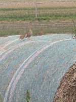
My definition of "Pockets" equals habitat. That is all a pocket is. Where there is habitat there are birds. Problem is that Kansas has had a huge decline in habitat. CRP had large acres expire in the last 15 years. In the last 2 years there has been more enrollment though. Farmers and Swathers (many from out of state) are always chomping at the bit for emergency haying and grazing of CRP lands. Wheat stubble is non-existent. And then there is round up sprayed everywhere. Wheat that doesn't mature due to drought leaves no nesting habitat. Shelterbelts have been taking out and old homesteads have been leveled for more farm ground. The little parcels that remain hold birds, which is a "Pocket".My definition and use of the term:
When I come acrossed good hunting "pockets" I'm referring to an area that the birds are in close proximity to each other based on the huntable size of a field that is bordering a small grain food source, a nesting or roosting habitat and a source of water (growing wheat field), and gravel on a County road for digestion purposes.
These spots can be the same year after year and predictable if it's CRP with a consistent crop rotation on the boarding three sides of it. Less predictable is when a crop rotation creates a new area, or a change in farming practice. The biggest change has been in the leftover wheat stubble that is holding roosts and has all of the same surroundings mentioned above. Additionally, these areas were not affected by a localized hail storm or a farming practice during the nesting. Similar to a surrogator, the birds that hatched in these areas will attract other birds from a large radius thus creating a "pocket".
The biggest challenge is obtaining permission to hunt these when they change year-to-year.
The days of planning a hunt at the same places every year, multiple times per season, and expecting to have success, are memories. There are not that many birds or ideal accessible habitat compared to 5, 10, 30+ years ago.
where is the data? I can't find it on the sates websiteLooking at the data, it appears that it contains some accuracy based on what I am seeing (and hearing in the mornings) in the counties surrounding me. However, the route in my specific county, was in an area that I feel had our lowest bird population as there it's not as much irrigation and/or the better habitat, therefore lower total crow counts overall. I'm sure it's all relative, so if that area improved, so did the "pocket" areas that have held most of the birds for many years. I'm expecting this year to be better than last, and last year was REALLY good!