2021-2022 Kansas WIHA Maps for Garmin GPS Units

Powderhorn Jim

Active member
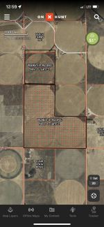
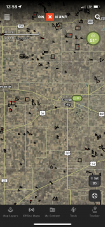
Over the years I have found the downloadable Kansas WIHA maps for my Garmin GPS invaluable. It sure beats driving around with the map booklet in your lap trying to figure out where you are! In past years Kansas has always made these files available in October. This year, less than a week before the opening of the 2021 Kansas Pheasant season they are still listed as "coming soon" on the KDWP website. They have the files for phones and Google Earth but in the areas I hunt, cell reception is mostly poor to non-existent.

Anyone have any information (or contacts in KDWP) as to when these files will be available, if at all? I can do it the old way, but I'm dreading it.
 
I'm interested in this as well as my Garmin is my main hunt navigator as well due to cell phone coverage.. Have you tried calling the service line, I had it on my "to do" list for today. I'll let you know if I find anything
 
If you have the argis ap open you can navigate without a data connection. You just need the area your going to be in up before you lose your data connection. You can’t map it but you can keep track of where you are.
 
I'm interested in this as well as my Garmin is my main hunt navigator as well due to cell phone coverage.. Have you tried calling the service line, I had it on my "to do" list for today. I'll let you know if I find anything
I tried their email "info" address and their "webmaster". Neither produced results so far. Please let me know if you have any luck with their help line. Hopefully it is someone with a Kansas accent that answers!
If you have the argis ap open you can navigate without a data connection. You just need the area your going to be in up before you lose your data connection. You can’t map it but you can keep track of where you are.
 
If you have the argis ap open you can navigate without a data connection. You just need the area your going to be in up before you lose your data connection. You can’t map it but you can keep track of where you are.
That is an option but it is oh-so-much-easier to have the file on your automotive GPS. I've unfortunately had to work with arcgis over the years and have found it cumbersome and frustrating if you don't work with it everyday, but it may be our only option this year, unfortunately.
 
I'm interested in this as well as my Garmin is my main hunt navigator as well due to cell phone coverage.. Have you tried calling the service line, I had it on my "to do" list for today. I'll let you know if I find anything
Had some time so I called the Secretary's office. After 3 transfers I finally found a person that knew at least part of what is going on. The GIS position has been vacant since July. The Wildlife Director put together the maps for the booklet and likely for Google Earth and arcgis. The lady had no idea if he planned on or had the capability of assembling the maps in a file compatible with Garmin GPS units. He is out today but she left a message requesting he call me tomorrow. I'll update this thread if I get any good (or bad) information. For now, I wouldn't delete your 2020-21 Kansas file on your Garmin GPS. It won't have areas added or deleted but it, in combination with the paper maps will be better than nothing.

Guess I better get friendly with arcgis...
 
It's a time consuming exercise but you can save the GE file, then convert it to GPX using a free online tool called gpsvisualizer. Then open the GPX file in BaseCamp and manually drop a waypoint flag in the center of each tract so can filter on just the waypoints and send to your Garmin. I've had to do this for Nebraska for the past several years.
 
I noticed a few new spots show up using onX that aren't in the booklet (at least in our area).
 
So generally I like the paper maps, but I supplement with my phone. Showing my age I guess. The screen on my phone is just too small and I refuse to keep a tablet in the truck or use a dash-mounted GPS unit.

Anyway, this year's paper map showed HUGE losses of tracts in the areas I hunt. I was really frustrated. Then I went and looked on-line. Most of them were there. Somehow they didn't make the booklet.

It reminded me of a conversation I had with the local KDWP biologist last spring. I was commenting on a particular tract that was absent from last year's booklet AND the online tool, but yet the signs were still up. I'm paraphrasing, but he essentially said that he didn't get everything turned in for the 20-21 booklet and online stuff because of COVID. Seems like he said something about lost files in the transition to working from home. Now the 21-22 booklet is even worse in this area, but at least the on-line stuff is there.
I haven't heard back from anyone at KDWP yet, but have a friend that is a GIS manager out here that is going to attempt to convert their Google Earth file to one compatible with Garmin GPS units. If he is successful I will make it available here if I am allowed to. The comments from matto do concern me. If the GIS position was vacant since July, and if all enrolled tracts weren't submitted/included in their printed and/or online publications, we are going to be hard put to make sense of what is going on out in the field. I believe the KDWP WIHA signs control, but I know of several parcels that have old WIHA signs on their more remote sides that truly are not, and haven't been enrolled for years. I don't want to get into a confrontation with a landowner or law enforcement, so even with posted signs, if it is not on the printed version and (for previous years) their Garmin GPS map, I shy away.
 
@Powderhorn Jim

Here's a simpler solution -- just pay for a $29.99 fee for Onxmaps access to KS -- they have offline downloadable maps where you choose what areas of the state and detail level to download and the WIHA parcels are a layer you can turn on -- I just take my tablet with me as it's easier to see on the larger screen but normally have cell reception where I go - if you have Verizon works in 95% of the state very well - there are some beaten path places it's spotty but once you get to a town it works fine. Anyways the offline maps on OnxMaps you will NEED to download over Wifi - even with Verizons solid coverage it never works worth a crap over Cell Data.

I like google earth but it's clunky on mobile -


Honestly It's way easier for me to read a map and navigate that way than use the phone for going parcel to parcel - the only thing the google earth file or Onxmaps is good for is getting an idea of what the terrain looks like around - even then it just gives you an idea as the aerials are never current.
 
X2 kshusker…. Was just cruising around OnX yesterday and it looks like they’re pretty updated on the WIHA.
 
So far nothing from KDWP staff and no luck converting their Google Earth .kmz file to Garmin's .img format (which of course is proprietary). I looked at HuntStand (competitor to OnX) and they still have the 2020-21 files. Those of you that subscribe to OnX, could you take a look at the printed or online 2021-22 maps and see if OnX is current or if they are still using the 2020-21 files? This is starting to look like a fuddled mess, as far as using our Garmin GPS units. Likely we'll end up using last year's GPS maps and cross-checking with the printed maps (which may or may not be current, it appears).
 
OnX seems to be current, at least in the areas I hunt. As recently as a few weeks ago they were still showing last year's maps, but they seem to be up to date now. I've been doing some online scouting the last few days and OnX shows the same tracts as KDWP's online tool in the areas I'm researching.
 
When I looked the other day, onX was current with the online explorer site on the KDWP site. Not so much the booklet. I had them mail me one last week and it seems to be missing several in my area. We don't hunt a ton of WIHA but I figured I'd just go off of onX and if there aren't signs when the get there then go on. Also, I'm red/green colorblind and the explorer site is a bear for me to see the red ones. OnX outlines them in black so I just work better with that.

I should say that I also use a Garmin Alpha and i've never really even thought about messing with the GPS files for it. OnX is just too convenient plus it can be used offline.

Here are a couple of examples of what WIHA looks like on onX. You can make 5 mile high res/10 mile medium res/150 mile low res maps. Name your map. Download it to your phone. If you get out of service, select map and click go offline. Your gps on your phone still works when you have no service.
 

Attachments

  • 1837038D-D3A2-4908-9517-C0F993A51A81.png
    1837038D-D3A2-4908-9517-C0F993A51A81.png
    6.9 MB · Views: 7
  • DF666203-4486-40D9-AA9F-4DD548217A4D.png
    DF666203-4486-40D9-AA9F-4DD548217A4D.png
    9.1 MB · Views: 7
Last edited:
Thanks. I normally hunt 3 states, Kansas, South Dakota and North Dakota. All have provided excellent coverage of their public hunting areas (WIHA, state land, PLOTS, etc.) I never gave a thought to whether their maps, whether electronic or paper were accurate and complete. Of course we never had Covid to deal with, which affected where folks worked, how much they could work and the quality of their work, but whatever, now I am concerned that Kansas has dropped the ball. At least OnX seems to have picked it up. I am in contact with HuntStand as well to see if they are going to update their maps, but neither, in my humble opinion, are as easy to use as a simple automotive GPS with the maps loaded. That said, it is what it is and I'm pretty sure we'll find places to hunt!
When I looked the other day, onX was current with the online explorer site on the KDWP site. Not so much the booklet. I had them mail me one last week and it seems to be missing several in my area. We don't hunt a ton of WIHA but I figured I'd just go off of onX and if there aren't signs when the get there then go on. Also, I'm red/green colorblind and the explorer site is a bear for me to see the red ones. OnX outlines them in black so I just work better with that.

I should say that I also use a Garmin Alpha and i've never really even thought about messing with the GPS files for it. OnX is just too convenient plus it can be used offline.

Here are a couple of examples of what WIHA looks like on onX. You can make 5 mile high res/10 mile medium res/150 mile low res maps. Name your map. Download it to your phone. If you get out of service, select map and click go offline. Your gps on your phone still works when you have no servic
 
Yea regarding the other states and onX, who knows.... I'm from Oklahoma and we have a walk in program (much smaller than kansas). Our maps are not on onX. Wish they were.
 
Thanks. I normally hunt 3 states, Kansas, South Dakota and North Dakota. All have provided excellent coverage of their public hunting areas (WIHA, state land, PLOTS, etc.) I never gave a thought to whether their maps, whether electronic or paper were accurate and complete. Of course we never had Covid to deal with, which affected where folks worked, how much they could work and the quality of their work, but whatever, now I am concerned that Kansas has dropped the ball. At least OnX seems to have picked it up. I am in contact with HuntStand as well to see if they are going to update their maps, but neither, in my humble opinion, are as easy to use as a simple automotive GPS with the maps loaded. That said, it is what it is and I'm pretty sure we'll find places to hunt!

KS Govt has problems in all facets of govt -- we deal in senior care and they have severe turnover and staffing shortages -- they've always been there but it's just gotten worse -- Sam Brownback started it years ago and the problem has never gotten better -- not really the staff that are still around fault at all - poor management from years ago and getting their budgets stripped -- some depts are pretty wasteful - but KDWP and the agencies we deal with in senior care dont seem to be -

Now I saw something around with the state or our local govt claiming they have workforce shortages for snow clearing -- - basically prepping us for the roads to not be cleared - no big deal I guess - unless you want to travel long distances in winter - then it's a PITA or can only go in the daylight hours ideally.
 
Just received a call from KDWP. They proofed the Garmin GPS file for 2021-22 and posted it today: https://ksoutdoors.com/KDWP-Info/Lo...s/Hunting-Atlas/Garmin-GPS-Google-Earth-Files

I took a quick look at an area I'm familiar with and it matches their printed Atlas and the online version. I am HAPPY! No driving around with maps in my lap, no worrying about cell coverage, no purchasing and learning new software/apps.

And, I have to say that folks that work for wildlife agencies are trying to do their jobs with minimal resources. I have friends in KDWP and they are good people doing the best, most professional jobs they can with the resources they are given. Thanks to them and the participating landowners, Kansas has one of, if not the best walk-in hunting area program in the U.S. Without it I would be reduced to pheasant "golfing" on a preserve here in Colorado.
 
Back
Top